From laser scanning and drone surveying to custom software development – we deliver the highest precision to your projects.
Discover our expertiseInterdisciplinary surveying, geomatics & software team — for over 15 years.
BAKOM-compliant antenna & NIS simulations for the Swiss mobile network industry.
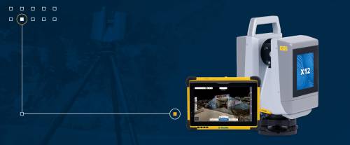
We work with the most modern surveying technology.
geodigital AG offers a high degree of experience in various disciplines of surveying. From the procurement of basic data such as terrain models or 3D building models to surveying during construction and beyond, we are happy to advise you. We also offer software development as a service – from the conception of individual solutions through development and integration to the support of complex geoinformation systems and data processing workflows.
geodigital AG combines classical surveying expertise with modern software engineering. Our interdisciplinary team of surveyors, engineers and developers delivers high-precision data, BIM models and tailor-made geo-solutions — across Switzerland, in true partnership.
geodigital AG offers a high degree of experience in various disciplines of surveying. From the procurement of basic data such as terrain models or 3D building models to surveying during construction and beyond, we are happy to advise you.












3D laser scanning, drone surveying, BIM or a tailor-made software solution — we will advise you with no obligation and find the right answer for your needs.